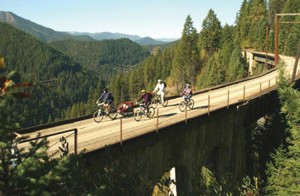
Hiawatha Trail
North Idaho’s parks and back country are laced with trails, many leading to lakes or streams, and most offering magnificent viewpoints.

The North Idaho Centennial Trail
The North Idaho Centennial Trail is a multi use recreational trail, which meanders for 24 miles from the state line at the Idaho/ Washington border to beautiful Higgins Point, six miles east of Coeur d’Alene. This scenic trail runs along the Spokane River to Post Falls where it runs through neighborhoods and eventually to wooded areas leading to Coeur d’Alene. At the west end of Coeur d’Alene the trail again meets the Spokane River and follows it to the pristine Lake Coeur d’Alene, The trail then follows the lake shoreline to Higgins Point, an Idaho State Park, which draws throngs of spectators in the late fall and early winter to view the annual visit of Bald Eagles as they migrate south. This scenic trail composed primarily of Class I separated and paved trail with some small segments of Class II trail. The trail has numerous rest areas, scenic views and historical interpretative signs to add to the enjoyment of one of the most beautiful trail systems in the country. the North Idaho Centennial Trail offers accessibility to walkers, runners, bicyclists, handicapped and people of all ages. There are no economic barriers to the public, but there is one stipulation: ENJOY IT!
Download the North Idaho Centennial Trail Map.
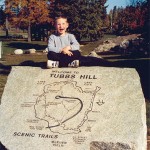
Tubbs Hill
Tubbs Hill features outstanding viewpoints, woodland habitats and historical focal points. The self-guided walk follows a two-mile loop, beginning and ending at the south end of the parking lot between McEuen Park and the Coeur d’Alene Resort.
Mineral Ridge Trail
Mineral Ridge Trail is a 3.3-mile path that is an outdoor classroom in the forest. There are 22 stations numbered along the trail identifying features found naturally at Mineral Ridge. The trail climbs 735 feet to an elevation of 2,875 feet for a spectacular view of Lake Coeur d’Alene and the surrounding mountains. The trail begins at Beauty Bay and is accessed off Highway 97.
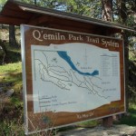
Q’emiln Trail
Q’emiln Trail in Post Falls is home to marmots, osprey and other wildlife. The set of 14 trails starts at South City Park and winds through four miles of the Spokane River gorge. A map at the trail head marks the route.

The Route of the Hiawatha
The Route of the Hiawatha has been called one of the most scenic stretches of railroad in the country, and now, the historic converted Milwaukee Road rail bed is one of the most spectacular biking and hiking trails in the world. Visitors can witness rushing mountain streams, deer, elk, moose and an endless vista of the towering Bitterroot Mountains. The 15 mile trail winds through 10 tunnels and over 7 trestles in the rugged bitterroot mountains on the Idaho/ Montana border. The route is best known for the long, dark St. Paul or “Taft Tunnel” that burrows for 1.7 miles under the state line. The best part is – it’s all downhill at a mild 2% grade and provides a shuttle service back to the top. Helmets and lights are required, as are trail tickets, and both rentals of equipment (including bikes) and tickets are available at the Lookout Pass Ski area lodge. Call 208-744-1301
Download Route of the Hiawatha Map
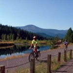
The Trail of the Coeur d’Alenes
The Trail of the Coeur d’Alenes is a rail to trail conversion which began as a path originally used by the Coeur d’Alene Indians that evolved into a mining transportation rail line operating from 1887 until 1992. It has 72 miles of paved path that stretches from Mullan to Plummer. The trail crosses 40 bridges and goes through 13 towns.
Trail of the Coeur d’Alenes Map and checklist of birds on the trail
The Pulaski Trail is a two-mile interpretive trail that tells the story of 1910 Ranger Edward Pulaski. The trail begins one mile south of Wallace and culminates at the abandoned mine where Pulaski saved his crew.
Spirit Lake – Larch Mountain, a 7.1 mile loop trail that takes you high enough for panoramic views of historic Spirit Lake, both the town and the lake. North on Hwy 41 from Rathdrum. Access the trail from the public boat launch/city beach area.
Bernard Peak Loop Mountain Bike Route is located north of Coeur d’Alene and is an 18.5 mile loop on gravel road with single and double track with views of the southern end of Lake Pend Oreille.
Mt. Coeur d’Alene Mountain Bike Loop with it’s outstanding views of the lake and the Coeur d’Alene area is an 8.1 mile loop on a gravel road. Contact the Forest Service (208-769-3000) for a brochure.
Canfield Mountain Bike Trail 1562, near Coeur d’Alene, has more than 32 trail miles in the system. It was designed for motorized trail bikes and mountain bikes and is open for all uses except for ATV’s. The trail is set up so the entire system can be accessed from an old logging road, FS Road #1562. The trails are a mix of logging roads and single-track, they range from a 0-35% grade. Trails can be smooth, maintained logging roads or steep with loose rocks, roots, drop-offs and other obstacles. Canfield Mountain Map – Forest Service
South Fork Coeur d’Alene River Bike Trails is east of Coeur d’Alene near Cataldo. Trails range from easy to difficult and take hikers through alpine lakes or former railroad tunnels.
Beason Meadows Bike Trail #228, near Potlatch, passes through a variety of plant life as it climbs from the stream bottom. The first mile is marked as part of a national recreation trail system near the Giant White Pine Campground. The trail ends at Bald Mountain Lookout.
Strong Creek Mountain Bike Trail, for mountain bikers, this ridge-top single track trail is one of the must-see rides in the area. Contact the Forest Service (208-263-5111) for a brochure.
Sandpoint Dufort Road Loop Bike Path and Trail takes you along the Pend Oreille River and can be accessed south of Sandpoint. The roads on this route are well traveled and heavy mixed traffic will be encountered. A small stretch of Lakeshore Drive has a gravel surface. The sloughs along the river provide excellent opportunities to view water fowl. Contact the Forest Service (208-263-5111) for a brochure.
Green Bay-Mineral Point Mountain Trail is a 7-mile loop of trail and road that follows the shoreline of beautiful Lake Pend Oreille, 12 miles southeast of Sandpoint.
Jeru Creek Road Mountain Bike Road if combined with Pack River Road, is a 16.8 mile ride north of Sandpoint for intermediate and advanced levels. Once on the ridge, there are great views of the Selkirk Crest and the Pack River valley. Contact the Forest Service (208-263-5111) for a brochure.
Johnson Cabin-Granite Creek Mountain Bike Trail near Lake Pend Oreille, east of Sandpoint, is a 16 mile round trip ride on the east side of Lake Pend Oreille for both intermediate and advanced levels. Contact the Forest Service (208-263-5111) for a brochure.
Schweitzer Mountain Resort
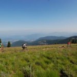
Schweitzer Mountain Resort has a vast trail system for hiking or biking. Elevation gain of the mountain trails is 2,400 feet. Bikers wanting a less strenuous ride can take the Great Escape quad chairlift to the top of Schweitzer Peak and enjoy a leisurely ride down the mountain. Equipment rentals are available on site. Helmets are required on all Schweitzer trails. Call (208) 263-9555
Silver Mountain Resort Mountain Biking Trails
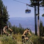
Silver Mountain Resort Mountain Biking Trails has a gondola that takes you to the top of the mountain, where you can ride 30+ miles of various track types and terrain. The Silver Mountain Nature Trail is a 2.8 mile loop, accessed at the base of the mountain at the gondola village. While there are trails suited for a variety of levels, intermediate to advanced level skills are recommended. (208) 783-1111, 610 Bunker Ave, Kellogg.
Silver Mountain-Big Creek Banzai Biking Trail near Silver Mountain Ski Resort is 14.8 miles long, one way, with a variety of track types. Trail is often shared with horseback riders and hikers.
Farragut State Park Mountain Bike Trails, two bike trails in Farragut State Park. The Shoreline Trail, located along the shore of Lake Pend Oreille about 3.5 miles in length, one way, on wide single track and a paved pathway. The Northside Loop is 4.7 miles of single track passing through grasslands and timber. The park located at 13550 E. Hwy. 54 Athol, (208) 683-2425.
Priest Lake Lakeshore Trail #294 is a popular and highly used trail in the area. It is a fairly simple hike and is crossed by five streams while paralleling Priest Lake. Beautiful views of the lake can be seen from the path. This trail passes through timber and hillsides of brush. There are numerous campsites along the trail offering beaches and isolation.
Upper Priest Lake Navigation Trail is an excellent mountain bike trail near Priest Lake. It is approximately 9.4 miles on single track in an old growth forest next to Priest Lake. Riders, hikers and joggers share the path. A few scattered campsites lay along the trail with campgrounds located at the north and south end of the lake. Contact the Forest Service (208-443-2512) for a brochure.
Emerald Creek Star Garnet dig near Clarkia is another fun outdoor activity with the chance to bring home some of the finest grade star garnets in the world. Operated by the Forest Service, a 1-day dig pass (inclueds equipment) is $10 for adults, $5 for kids 6-12. Take home what you find, 5 pound limit per day. Open Thursdays-Mondays, May-September.
Follow That Moose!
“Mudgy & Millie” is a children’s book written by local author Susan Nipp. Mudgy Moose searches high and low for his friend Millie Mouse along the shores of Lake Coeur d’Alene in Idaho. Families can join in the fun as Mudgy wanders into town in his quest to find Millie.
The Mudgy Moose Trail, created in conjunction with the City of Coeur d’Alene Parks Department, begins at the base of Tubbs Hill and ends at Independence Point, where Mudgy discovers that Millie was hiding close by all along.
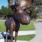
The 2-1/4 mile trail along Lake Coeur d’Alene and through Downtown Coeur d’Alene features five life-size bronze statues positioned at locations where Mudgy pauses in his search for Millie. Watch for the Mudgy Moose Trail signs which will guide you along the trail which is free to explore.